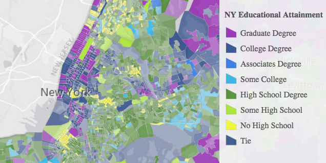
Legend
require(["esri/widgets/Legend"], function(Legend) { /* code goes here */ });esri/widgets/LegendThe Legend widget displays labels and symbols for layers in a map. Labels and their corresponding symbols depend on the values set in the Renderer of the layer. The legend will only display layers and sublayers that are visible in the view.
The legend automatically updates when
- the visibility of a layer or sublayer changes
- a layer is added or removed from the map
- a layer's
renderer,opacity, ortitleis changed - the
legendEnabledproperty is changed (set totrueorfalseon the layer)
You can use the view's DefaultUI to add widgets to the view's user interface via the ui property on the view.
Known Limitations
- Currently, the legend widget does not support the following layer types: ElevationLayer, GraphicsLayer, IntegratedMeshLayer, KMLLayer, MapNotesLayer, OpenStreetMapLayer, VectorTileLayer, and WebTileLayer.
- 3D symbols with more than one symbol layer are not supported.
- DictionaryRenderer is not supported.
var legend = new Legend({
  view: view,
  layerInfos: [{
    layer: featureLayer,
    title: "Legend"
  }]
});

view.ui.add(legend, "bottom-right");
Constructors
- new Legend(properties)
- Parameter:properties Objectoptional
See the properties for a list of all the properties that may be passed into the constructor.
Example:// typical usage var legend = new Legend({ view: view });
Property Overview
| Name | Type | Summary | Class | |
|---|---|---|---|---|
| Collection<ActiveLayerInfo> | Collection of ActiveLayerInfo objects used by the legend view to display data in the legend. more details | more details | Legend | |
| Boolean | Indicates whether to show the Basemap layers in the Legend. more details | more details | Legend | |
| String|HTMLElement | The ID or node representing the DOM element containing the widget. more details | more details | Widget | |
| String | The name of the class. more details | more details | Accessor | |
| Boolean | When | more details | Widget | |
| String | The widget's default CSS icon class. more details | more details | Legend | |
| String | The unique ID assigned to the widget when the widget is created. more details | more details | Widget | |
| String | The widget's default label. more details | more details | Legend | |
| Object[] | Specifies a subset of the layers to display in the legend. more details | more details | Legend | |
| Boolean | Determines whether to respect the properties of the layers in the map that control the legend's visibility ( | more details | Legend | |
| Object|String | Indicates the style of the legend. more details | more details | Legend | |
| MapView|SceneView | A reference to the MapView or SceneView. more details | more details | Legend | |
| LegendViewModel | The view model for this widget. more details | more details | Legend |
Property Details
- activeLayerInfos Collection<ActiveLayerInfo>autocast
Collection of ActiveLayerInfo objects used by the legend view to display data in the legend. The legend widget watches this property to hide or display the layer's legend when an ActiveLayerInfo is removed from or added to this collection.
- basemapLegendVisible Boolean
Indicates whether to show the Basemap layers in the Legend.
- Default Value:false
Example:legend.basemapLegendVisible = true;
The ID or node representing the DOM element containing the widget. This property can only be set once. The following examples are all valid use cases when working with widgets.
Examples:// Create the HTML div element programmatically at runtime and set to the widget's container const basemapGallery = new BasemapGallery({ view: view, container: document.createElement("div") }); // Add the widget to the top-right corner of the view view.ui.add(basemapGallery, { position: "top-right" });// Specify an already-defined HTML div element in the widget's container const basemapGallery = new BasemapGallery({ view: view, container: basemapGalleryDiv }); // Add the widget to the top-right corner of the view view.ui.add(basemapGallery, { position: "top-right" }); // HTML markup <body> <div id="viewDiv"></div> <div id="basemapGalleryDiv"></div> </body>// Specify the widget while adding to the view's UI const basemapGallery = new BasemapGallery({ view: view }); // Add the widget to the top-right corner of the view view.ui.add(basemapGallery, { position: "top-right" });
- Since: ArcGIS API for JavaScript 4.7
The name of the class. The declared class name is formatted as
esri.folder.className.
When
true, this property indicates whether the widget has been destroyed.
- iconClass StringSince: ArcGIS API for JavaScript 4.7
The widget's default CSS icon class.
The unique ID assigned to the widget when the widget is created. If not set by the developer, it will default to the container ID, or if that is not present then it will be automatically generated.
- label StringSince: ArcGIS API for JavaScript 4.7
The widget's default label.
Specifies a subset of the layers to display in the legend. If this property is not set, all layers in the map will display in the legend. Objects in this array are defined with the properties listed below.
- respectLayerVisibility BooleanSince: ArcGIS API for JavaScript 4.13
Determines whether to respect the properties of the layers in the map that control the legend's visibility (
minScale,maxScale,legendEnabled). By default, a layer's legend elements will not render in the legend given the following conditions:- The layer's legendEnabled property is set to
false. - If the view's scale is outside the visibility range defined by the layer's minScale and maxScale properties.
When the
respectLayerVisibilityproperty of the legend is set tofalse, the legend elements for each layer in the map will always display, thus disregarding theminScale,maxScale, andlegendEnabledproperties for each layer in the map.- Default Value:true
Example:// Always displays legend elements for the map's layers // regardless of their minScale, maxScale, and legendEnabled properties legend.respectLayerVisibility = false;- The layer's legendEnabled property is set to
- Since: ArcGIS API for JavaScript 4.7
Indicates the style of the legend. The style determines the legend's layout and behavior. You can either specify a string or an object to indicate the style. The known string values are the same values listed in the table within the
typeproperty.- Properties:
- type String
Specifies the style of the legend. There are two possible values listed in the table below:
Value Description classic The legend has a portrait orientation. The user can scroll vertically when many elements are included in the legend's content. card In wide views, the legend has a landscape orientation that allows users to scroll horizontally to view all legend elements. This style can be responsive, making it ideal for mobile web apps. In smaller views, the legend collapses to occupy less space. One element is shown at a time in a card-style layout, which the user can navigate horizontally. optionallayout StringDefault Value:stackWhen a
cardtype is specified, you can specify one of the following layout options.Value Description auto This layout is responsive so that in wide views the legend has a side-by-sidelayout, and astacklayout in smaller (mobile) views.side-by-side The legend has a landscape orientation that allows users to scroll horizontally to view multiple legend cards at a time. stack The legend cards are stacked, which conserves space, but restricts the user to seeing only one card at a time. Possible Values:"auto"|"side-by-side"|"stack"
- Default Value:classic
Examples:// renders the legend in the card style with a "stack" layout legend.style = "card";// renders the legend in the card style with a responsive // layout that toggles between "stack" and "side-by-side" legend.style = { type: "card", layout: "auto" };// renders the legend in the classic layout legend.style = "classic";
- viewModel LegendViewModelautocast
The view model for this widget. This is a class that contains all the logic (properties and methods) that controls this widget's behavior. See the LegendViewModel class to access all properties and methods on the widget.
Method Overview
| Name | Return Type | Summary | Class | |
|---|---|---|---|---|
| String | A utility method used for building the value for a widget's | more details | Widget | |
Destroys the widget instance. more details | more details | Widget | ||
| Boolean | Emits an event on the instance. more details | more details | Widget | |
| Boolean | Indicates whether there is an event listener on the instance that matches the provided event name. more details | more details | Widget | |
| Object | Registers an event handler on the instance. more details | more details | Widget | |
Widget teardown helper. more details | more details | Widget | ||
This method is primarily used by developers when implementing custom widgets. more details | more details | Widget | ||
| Object | This method is primarily used by developers when implementing custom widgets. more details | more details | Widget | |
Renders widget to the DOM immediately. more details | more details | Widget | ||
This method is primarily used by developers when implementing custom widgets. more details | more details | Widget |
Method Details
- Since: ArcGIS API for JavaScript 4.7
A utility method used for building the value for a widget's
classproperty. This aids in simplifying CSS class setup.Parameter:repeatable The class names.
Returns:Type Description String The computed class name. Example:// .tsx syntax showing how to set CSS classes while rendering the widget render() { const dynamicIconClasses = { [CSS.myIcon]: this.showIcon, [CSS.greyIcon]: !this.showIcon }; return ( <div class={classes(CSS.root, CSS.mixin, dynamicIconClasses)} /> ); }
- destroy()inherited
Destroys the widget instance.
- Since: ArcGIS API for JavaScript 4.5
Emits an event on the instance. This method should only be used when creating subclasses of this class.
Parameters:type StringThe name of the event.
event ObjectoptionalThe event payload.
Returns:Type Description Boolean trueif a listener was notified
Indicates whether there is an event listener on the instance that matches the provided event name.
Parameter:type StringThe name of the event.
Returns:Type Description Boolean Returns true if the class supports the input event.
Registers an event handler on the instance. Call this method to hook an event with a listener.
Parameters:A event type, or an array of event types, to listen for.
listener FunctionThe function to call when the event is fired.
Returns:Type Description Object Returns an event handler with a remove()method that can be called to stop listening for the event(s).Property Type Description remove Function When called, removes the listener from the event. Example:view.on("click", function(event){ // event is the event handle returned after the event fires. console.log(event.mapPoint); });
- own(handles)inherited
Widget teardown helper. Any handles added to it will be automatically removed when the widget is destroyed.
Parameter:handles WatchHandle|WatchHandle[]Handles marked for removal once the widget is destroyed.
- postInitialize()inherited
This method is primarily used by developers when implementing custom widgets. Executes after widget is ready for rendering.
This method is primarily used by developers when implementing custom widgets. It must be implemented by subclasses for rendering.
Returns:Type Description Object The rendered virtual node.
- renderNow()inherited
Renders widget to the DOM immediately.
- scheduleRender()inherited
This method is primarily used by developers when implementing custom widgets. Schedules widget rendering. This method is useful for changes affecting the UI.